


ABOUT
DAVID SCHMOLLER
Originally from Illinois, he lived in Wisconsin, South Dakota, and Montana. He currently lives in western Nebraska, but works in WI, MI, MN, ND, SD, WY, MT. He has been at this professionally since 1989 and non-professionally since 1978. He is assisted by his trusted field hand Amy Schmoller.
OVERVIEW
Since 1989, we have been performing ecology, botany, and wildlife surveys for Federal and State agencies. The last 25 years as a private contractor, the preceding 13 years employed by federal and state agencies in a variety of botany, ecology, and wildlife‐related work.
Primary responsibilities have been rare species surveys, botany surveys, vegetation inventories, wildlife surveys, wetland delineations, natural area inventories, natural community classification, biological evaluations, biological assessments, common stand exams, and technical writing.
* 250,537 acres and 2,242 miles surveyed since 1991.
* 7,270 rare plant populations on the Dakota Prairie Grasslands containing an estimated 892,132 plants since 2002. And millions more on Buffalo Gap National Grassland and thousands on six National Forests around the Great Lakes.
* Five Merit Awards from the U. S. Forest Service.
Regions: Northern Great Lakes, Northern Great Plains and Northern Rocky Mountains.
Habitats: Dune forests, oak savanna, boreal forest, tallgrass prairie, mixed grass prairie, intermountain grasslands, Ponderosa pine forest, Lodgepole pine forest, Douglas fir forest, sandhills, badlands.
States: Michigan, Wisconsin, Minnesota, North Dakota, South Dakota, Wyoming, and Montana. Also explored flora and fauna in Ecuador, Belize, Mexico, Costa Rica, Nicaragua, and Peru.
National Forests: Beaverhead‐Deerlodge, Chequamegon‐Nicolet, Chippewa, Custer, Gallatin, Huron‐Manistee, Lewis and Clark, Ottawa, Superior.
National Grasslands: Buffalo Gap, Cedar River, Grand River, Little Missouri, Sheyenne.
Details: ...are below. There are sample reports in all the main headings: Rare Species, Botany, Wildlife, and Wetlands. More information concerning our whereabouts may be found on the Travels page. And there is yet more at our Blog and Facebook page.
EDUCATION
BS Natural Environmental Systems, NIU - Dekalb
Additional coursework in Botany at UW - Madison
USACOE Wetland Delineations I
USFS classes in Botrychium, Asteraceae, Carex, aquatic macrophytes, and wildland firefighting.
AWARDS
Merit Award Chequamegon-Nicolet NF Rare Species Program 2000
Merit Award Chequamegon-Nicolet NF Botany Program 1997
Merit Award Chequamegon-Nicolet NF Rare Species Program 1996
Merit Award Custer NF Range Program 1995
Merit Award Nebraska NF Rare Species Program 1993
PROJECTS
Status Surveys and Reports
This list contains 25 surveys with extensive descriptions and analysis.
Status Survey Astragalus barrii 1994 - Buffalo Gap NG
Status Survey Eriogonum visheri 1994 - Buffalo Gap NG
Element Stewardship Abstract, Eriogonum visheri 2000 - TNC
Status Survey Chenopodium subglabrum 2002 - GRNG
Status Survey Rare Plants Bullion Butte 2003 - GRNG
Rare Plant Fact Sheets for 25 species 2003 - MNNHP
EO Ranking for 21 rare plant species 2003 - WIDNR
Status Survey Eriogonum visheri 2004 - LMNG
Status Survey Eriogonum visheri 2006 - LMNG
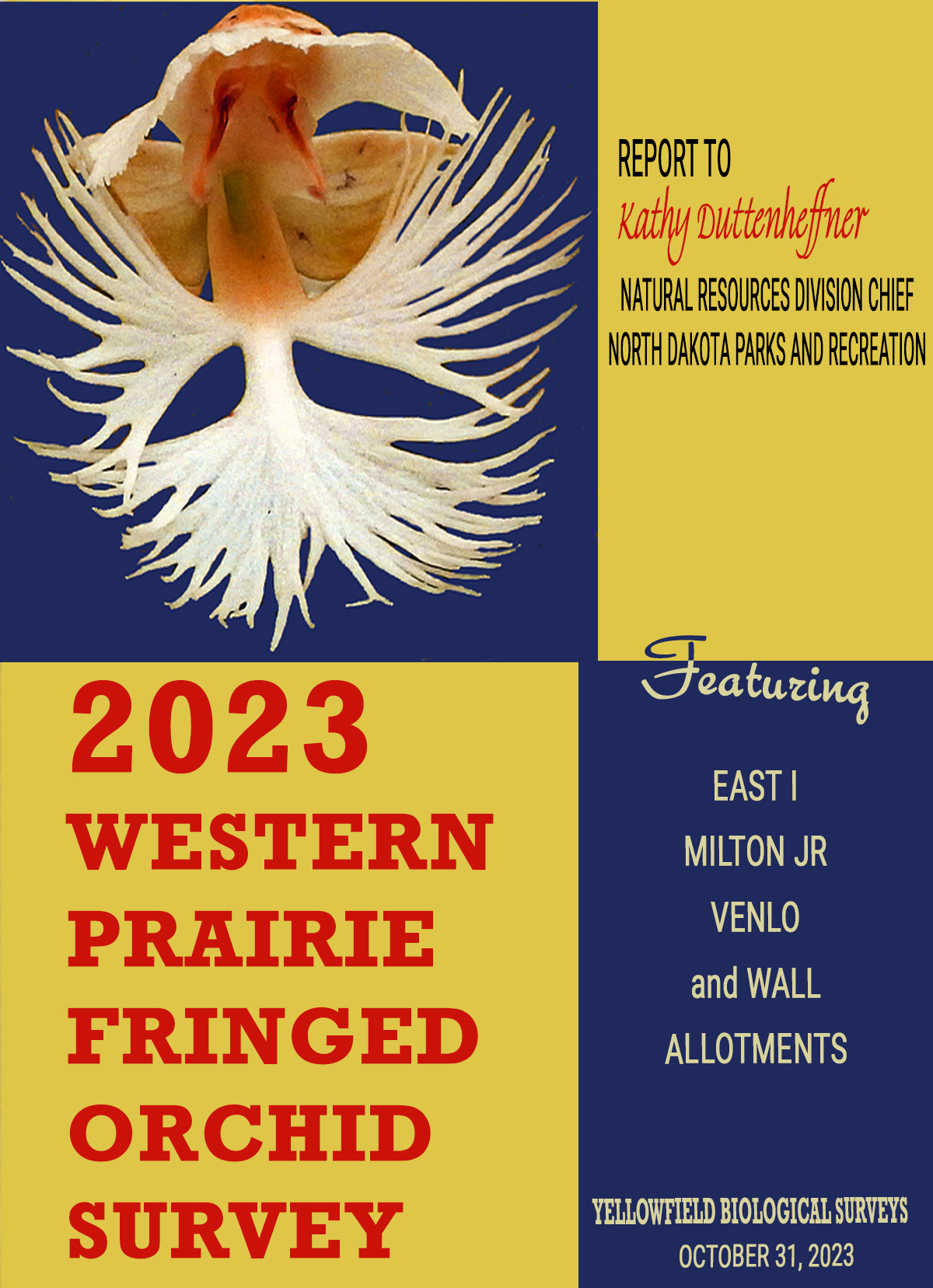
Status Survey Platanthera praeclara Survey, 3627 ac, 560 plants, NDNHP, Sheyenne NG, 2006
Status Survey Platanthera praeclara Survey, 4470 ac, 1433 plants, NDNHP, Sheyenne NG, 2007
Status Survey Chenopodium subglabrum 2007 - GRNG
Aquatic Macrophyte Survey and Assessment, Lac Vieux Desert 2007 - CNNF
Status Survey Platanthera praeclara Survey, 2995 ac, 1149 plants, NDNHP, Sheyenne NG 2008
Status Survey Talinum parviflora 2008 - CRNG
Status Survey for 11 rare plant species 2009 - Sheyenne NG
Status Survey Rare Plants L+C National Trail 2010
Status Survey, Platanthera praeclara Survey, 4200 ac, 853 plants, NDNHP, Sheyenne NG, 2018
Status Survey, Platanthera praeclara Survey, 5134 ac, 634 plants, NDNHP, Sheyenne NG, 2019
Status Survey, Platanthera praeclara Survey, 5106 ac, 124 plants, NDNHP, Sheyenne NG, 2020
Status Survey, Platanthera praeclara Survey, 5198 ac, 318 plants, NDNHP, Sheyenne NG, 2021
Status Survey, Platanthera praeclara Survey, 4827 acres, 1192 plants, NDNHP, Sheyenne, NG, 2022
Status Survey, Platanthera praeclara Survey, 4669 acres, 1516 plants, NDNHP, Sheyenne, NG, 2023
Status Survey, Platanthera praeclara Survey, 4987 acres, 3686 plants, NDNHP, Sheyenne, NG, 2024
Status Survey, Chenopodium subglabrum Survey, 12 sites, 553 plants, Little Missouri and Grand River National Grasslands, 2024
Biological Evaluations/Biological Assessments
This list contains quintessential evaluations and assessments with very extensive description and analysis, At least 89 were produced since 2008 and this list contains the majority.
Bicentennial Seismic, Eagle Nest Survey
BTA, DM #2 to DM #1 Flowline
Bicentennial Seismic, Eriogonum visheri Survey
Consolidated Telecom Fiber-optic Cable Route
Golden Valley County Road Improvement SC-FHC-1746(054)
NPC, Sand Creek Federal #1-21H
NPC, Sand Creek Federal #1-23H
NPC, Sand Creek Federal #1-27H
NPC, Sand Creek Federal #1-28H
NPC, Sand Creek Federal #1-29H Continental, Ole 1-29-H
St. Mary Land and Exploration, WRRMU South Field Project FE 3000340, Salt Water Gathering System
Braunberger Materials Pit, Billings Co, ND
MRWD, Phase II Waterline Improvements
MRWD, Phase II Waterline Improvements, Golden Eagle Survey, May 2010; Supplemental Report to MRWD November 2009
MRWD, Phase II Waterline Improvements, Supplemental Report 2 to MRWD November 2009
NPC, Beowulf Federal 148-97-30-31-1H
NPC, Pittsburgh Federal 153-96-3-2H
NPC, Helsingborg Federal 153-96-22-27-2H
NPC, Sand Creek Federal #153-96-16-2H
NPC, Sand Creek Federal #153-96-21-28-2H
NPC, Sand Creek Federal #153-96-23-14-2H
Kodiak, Skunk Creek 16-23-14-2H
Kodiak, CHARGING EAGLE 9-14-11H
Kodiak, Skunk Creek 2-8-17-15H and 4-8-17-14H
Kodiak, Skunk Creek 9-2-3-5H and 16-2-3-13H
Williston Wastewater Treatment Facility Improvement Project
MRWD, Regional Transmission Main and Facilities Project
MRWD, Phase II Waterline Improvements, ADDENDUM – 5/9/11
MRWD, Phase II Waterline Improvements, Supplemental Report 2, ADDENDUM – 5/9/11
MRWD, Phase II Waterline Improvements, Supplemental Report 3, Raptor Survey
Oneok Rockies Midstream LLC, Stateline Plant to Rawson Pipeline Corridor
NPC, Berg Federal 149-97-30-31-1H
Oneok Rockies Midstream, LLC, Schneider 12-12TFH, Poly Gasline
NPC, Berg Federal 149-97-30-31-1H, Access Road, Supplemental Raptor Survey
MRWD, System IV Part I, Waterline Improvements
MRWD, System IV Part II Waterline Project - USFS Report
MRWD, System IV, Part II - FWS Report
NPC, Sand Creek State 153‐96‐16‐3H
WAWSP, Phase II Transmission Main - FWS Report
Williston Wastewater Treatment Facility Improvement Project, Revision
McLean Sheridan Brush and Blue Lake Expansion Project - Waterline
Divide Lateral, Crude Petroleum Gathering Pipeline
NPC, Helsingborg Federal 153‐96‐27H
Three Affiliated Tribes, Shell Creek Segment, Hidatsa Housing Development, Mountrail Co, ND
Fort Berthold Rural Water System, Mandaree Raw Water Pipeline
MRWD, System IV Part II Waterline Project - ADDENDUM
MRWD, System IV Part III - FWS Report
MRWD, System IV Part III - USFS Report
NPC, Pittsburgh Federal 153‐96‐3‐2H ADDENDUM
NPC, Sand Creek State 153‐96‐21‐28‐11H, ADDENDUM Rare Species and Survey Review
NPC, Sand Creek Federal 153-96-30H
Three Affiliated Tribes, Shell Creek Segment, Van Hook Housing Development, Mountrail Co, ND
NPC, Sand Creek Federal 153-96-30—2H/3H/11h Lek Survey and partial BE Report
NPC, Pittsburgh Federal 153-96-3-4H
Poppy Federal 2658 12‐17H,
Carson Federal 2658 13‐17H, Richland Co, MT, Migratory Bird and Sharp‐tailed Grouse Survey - BLM
MRWD, System IV Part IIIA Waterline - FWS report
MRWD, System IV Part IIIA Waterline _ USFS report
MRWD, System I ‐ Tobacco Garden Expansion - FWS Report
MRWD, System I - Tobacco Garden Expansion - USFS Report
WAWSP, R&T Epping - FWS Report
WAWSP, R&T Part II Service Area - FWS Report
WAWSP, Wheelock to Epping Waterline - FWS Report
WAWSP , BDW Service Area - FWS Report
WAWSP, Blacktail Service Area - FWS Report
WAWSP, Stanley Service Area - FWS Report
NPC, Sand Creek Federal 153‐96‐23‐14‐4H, 11H, 12H, 13H, 5HLW, BE/BA
NPC, Prairie Moon Federal 153‐96‐9‐4‐1H, 2H, 12H, 13H, BE/BA
NPC, Prairie Moon Federal 153‐96‐9‐4‐10H, 11H, 14HLW, BE/BA
MRWD, System I - Tobacco Garden Expansion, System IV Part 3, Raptor Survey, 10.7 miles, 325 ac, BE/BA, 2018
MCRWD, System I, Part II - Spring Creek Service, 2.21 miles, BE/BA, 2019
MCRWD, System I, Part II - Johnson Service, 0.27 mile, BE/BA, 2019
MCRWD, System IV, Part IV - Sather Dam Area, 47.7 miles, Botanical Surveys, 2019
Wetland Delineations
About 30 of these since 1995. A partial list:
Canyon Junction to Fishing Bridge, Yellowstone National Park, Wetland Delineations, November 2000
East Entrance to Sylvan Pass, Yellowstone National Park, Wetland Delineations, December 2000
Wetland Determination, David Beck #24-7H Site, Dunn Co, ND
Wetland Determination Edgewood Regional Stormwater and Sewer project, City of Bismarck, Burleigh Co, ND
Borrow Pit, Project No. SNH‐2‐013(054)262, PCN 2018, Field Wetland Delineation Report / May 2016
Pingree Road Improvements, Project No. HEN‐2‐052(040)244, PCN 21040, Field Wetland Delineation Report / Feb 2016
Ypsilanti Road Improvements, Project No. HEN‐2‐281(041)060, PCN‐21160, Field Wetland Delineation Report / Mar 2016
42nd Street Road Improvements, Project No. SU‐6‐986(121)125, PCN 21590, Field Wetland Delineation Report / Jan 2017
DeMers Preventative Maintenance, Project No. NHU‐6‐297(008)000, PCN 20832, Office Wetland Delineation Report / Mar 2016
GAOA – Mt Valhalla Snow Park & Developed Rec Access Road Design (Picnic Point Campground), Chequamegon National Forest, 2021
GAOA – Mt Valhalla Snow Park & Developed Rec Access Road Design (Luna‐White Deer Campground), Chequamegon National Forest, 2021
GAOA - Bass Lake Campground Road Improvements, Nicolet National Forest, 2022
GAOA - Black Lake Campground Road Improvements, Chequamegon National Forest, 2022
GAOA - Franklin Lake Campground Bridge Replacement, Nicolet National Forest, 2022
GAOA - Laurel Lake Campground Road Improvements, Nicolet National Forest, 2022
GAOA - Dalrymple Bridge, West Torch Bridge, and Sailor Creek Bridge replacements, Chequamegon National Forest, 2023
Rare Plant, Wildlife, Range, and Community Surveys
While these 61 surveys generated reports, they were simple census and/or inventory for rare plants, natural communities, and lacked extensive description and analysis. Some of the larger surveys were conducted while employed with the USFS or WIDNR. They are in approximate chronological order.
Nebraska NF, Range Analysis, 72300 ac, 1991
Wisconsin DNR, Shoreline Rare Plant Surveys, 1992
Chequamegon-Nicolet NF, Rare Plant Surveys, 2000 ac, 1992
Nebraska NF, Rare Plant, Rare Wildlife Surveys, 1400 ac, 1993
Nebraska NF, Rare Plant, Rare Wildlife Surveys, 2000 ac, 1994
WIDNR, Aquatic Plant Inventories, 2500 ac, 1994
Custer NF, Rare Plant Surveys, 3000 ac, 1995
Chequamegon-Nicolet NF, Rare Plant Surveys, 3500 ac, 1996
Chequamegon-Nicolet NF, Rare Plant Surveys, 1500 ac, 1997
Chequamegon-Nicolet NF, Rare Plant Surveys, 1300 ac, 1998
Chequamegon-Nicolet NF, Rare Plant Surveys, 3000 ac, 1999
Chippewa NF, Rare Plant Survey, 1335 ac
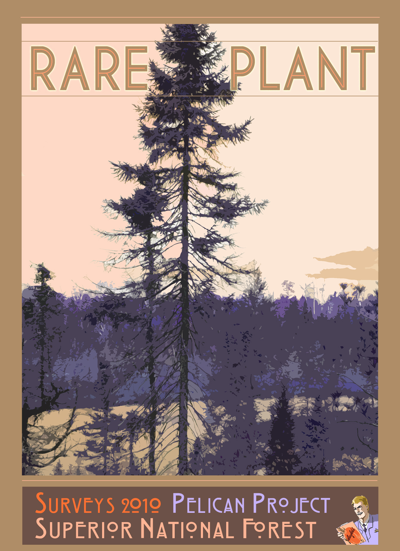
Superior NF, Rare Plant Survey, 435 ac
Ottawa NF, Rare Plant Survey, 700 ac
Wisconsin DNR, Rare Plant Survey, Rib Mountain SP, 378 ac
RI Bong Airport, Rare Plant Survey, 20 ac
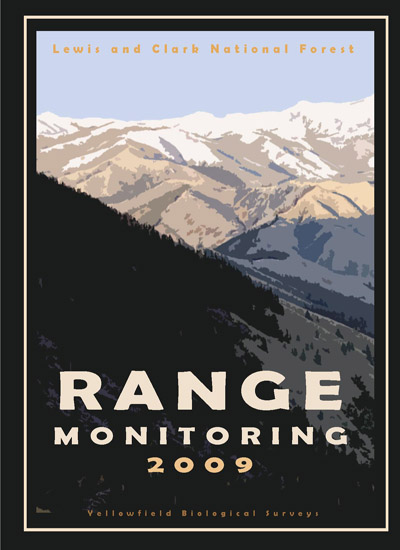
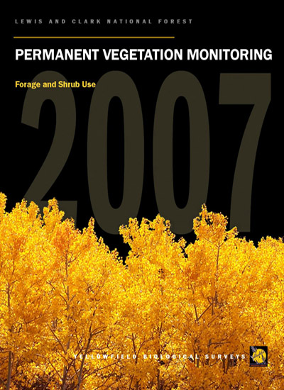
Lewis and Clark NF, Range Vegetation Monitoring, 33 plots
Chequamegon NF, Rare Plant Survey, 3988 ac
Chippewa NF, Rare Plant Survey, 1564 ac
STS Consultants, Eden Prairie Bog, Habitat Assessment
Chippewa NF, Rare Plant Survey, 1855 ac
Superior NF, Rare Plant Survey, 2050 ac
STS Consultants, Eden Prairie Bog, Habitat Assessment
Superior NF, Rare Plant Survey, 1020 ac
Ottawa NF, Rare Plant Survey, 243 ac
Lewis and Clark NF, Range Vegetation Monitoring, 52 plots
Chippewa NF, Rare Plant Survey, 1138 ac
Ottawa NF, Rare Plant Survey, 5462 ac
Chequamegon NF, Rare Plant Survey, 2310 ac
Superior NF, Rare Plant Survey, 3295 ac total
Chequamegon NF, Rare Plant Survey, 1349 ac
Lewis and Clark NF, Range Vegetation Monitoring, 24 plots
Superior NF, Rare Plant Survey, 2494 ac
Chequamegon NF, Rare Plant Survey, 1360 ac
Nicolet NF, Rare Plant Survey, 1032 ac
Lewis and Clark NF, Range Vegetation Monitoring, 29 plots
Superior NF, Rare Plant Survey, 849 ac
Chequamegon NF, Rare Plant Survey, 1312 ac
Nicolet NF, Rare Plant Survey, 2332 ac
Lewis and Clark NF, Range Vegetation Monitoring, 24 plots
Superior NF, Rare Plant Survey, 1083 ac
Gallatin NF, Rare Plant Survey, 32 miles of roadway
Beaverhead-Deerlodge NF, Rare Plant Survey, 2183 ac
Huron-Manistee NF, Rare Plant Survey, 345 ac
Superior NF, Rare Plant Survey, 651 ac
Lewis and Clark NF, Range Vegetation Monitoring, 24 plots
Wisconsin DNR, Rare Plant Survey, 2000 acres and 51 miles of river
Beaverhead-Deerlodge NF, are Plant Survey, 1157 ac
Huron-Manistee NF, Rare Plant Survey, 1669 ac
Lewis and Clark NF, Range Vegetation Monitoring Data Analysis, 53 plots
Beaverhead-Deerlodge NF, Rare Plant Survey, 1893 ac
Lewis and Clark NF, Range Vegetation Monitoring, 27 plots
Superior NF, Rare Plant Survey, 1910 ac
Huron-Manistee NF, Rare Plant Survey, 2095 ac
Huron-Manistee NF, Rare Plant Survey, 3340 ac
Huron-Manistee NF, Common Stand Exam, 1300 ac, 113 plots
Chequamegon-Nicolet NF, Rare Plant Survey, 3800 ac, 2018
Nicolet National Forest, Loneduck Project Rare Plant Survey, 3844 acres, 2022
Chequamegon National Forest, Kidrick Project Rare Plant Survey, 1909 acres, 2022
Little Missouri National Grassland, wildlife and botany monitoring for AE2S, 11,500 acres and 11 miles, 2023
Little Missouri National Grassland, wildlife and botany monitoring for AE2S, about 24,000 acres and 100 miles, 2024
Little Missouri National Grassland, wildlife and botany monitoring for AE2S, about 2,150 acres and 57 miles, 2025